The Capability
Charge in, cordon out, exposure live
- Enter the incident once: location, net explosive weight, fill, casing.
- The engine computes the rings: the K-factor overpressure cordons, the hazardous fragment distance, and the maximum fragment distance, with trinitrotoluene-equivalent conversion by fill.
- Push to the watch. On the wrist: distance and bearing to the incident, live overpressure at your current range, fragment hit probability, and the zone you are standing in.
- Escalation is physical. Crossing into a hotter zone vibrates the wrist. No looking required.
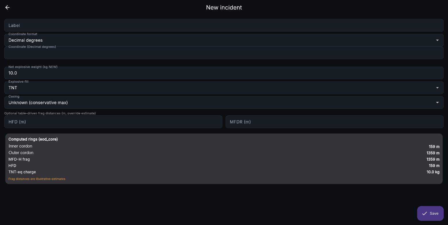
Incident entry: rings recompute live as charge parameters change
The Long WalkUnclassified
Feature · Companion
Planning tool in the browser, push tool on the phone
- Ready check walks the operator through setup: add incidents, set position, connect the watch. Steps check off as they complete.
- Coordinate formats that match the mission: decimal degrees, degrees-minutes, degrees-minutes-seconds, and military grid reference, with live echo so a mistyped grid is caught immediately.
- Multiple incidents held at once. The active one can be chosen by nearest range or by highest computed exposure.
- Metric or imperial, kilograms or pounds, converted at the display edge; the model stays in standard units underneath.
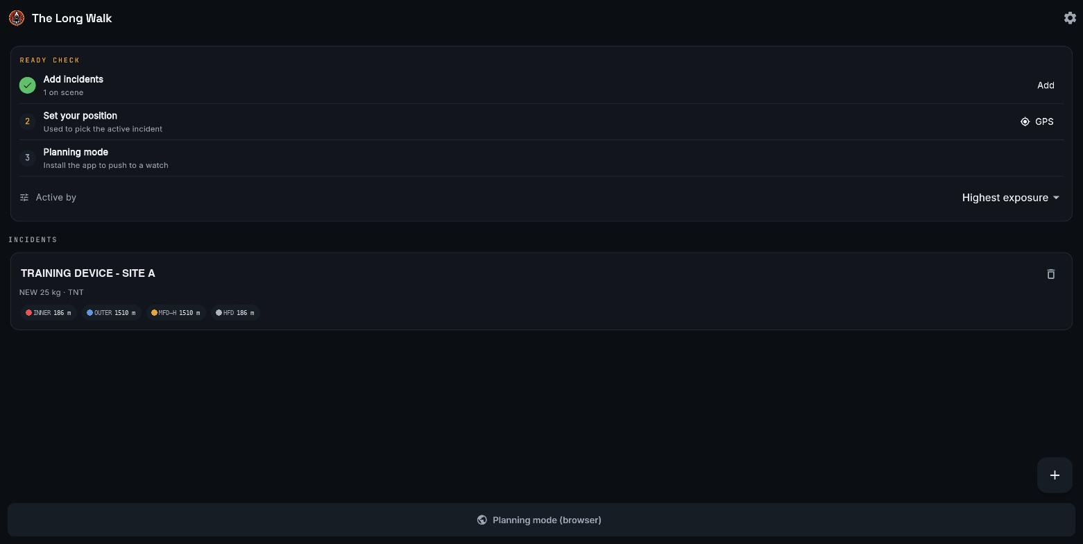
A 25-kilogram device: inner cordon 186 meters, outer 1510, fragment distances chipped on the card
The Long WalkUnclassified
Feature · Watch
The wrist display is the product
- Exposure hero face: overpressure and fragment hit probability side by side, zone named above, distance to clear below. The rim ring warms from green to red as danger grows.
- Cordon radar: the incident at center, cordon rings drawn and labeled, your position plotted at true range and bearing with a breadcrumb trail.
- Native activity recording with heart rate, saved to the training log like any workout.
- Waypoint export drops the incident into the watch navigation stack for the built-in map.
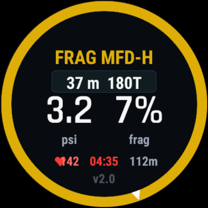
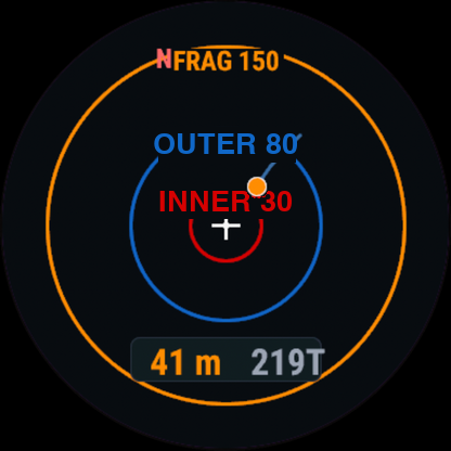
Actual watch captures: exposure face and cordon radar
The Long WalkUnclassified
Feature · Models
The models are written down and testable
- Airblast decay from published scaled-distance models drives the live overpressure readout.
- Fragment hit probability is anchored to the hazardous fragment distance definition, with the interior gradient composed from open sources rather than reproduced from any single one.
- Cordon recommendations reconcile the overpressure standoff with fragment throw, and the governing constraint wins. Where local direction sets a more conservative distance, that distance governs and the app does not attribute it to a public standard.
- Three technical whitepapers document the cordon model, the exposure and injury model, and the multi-incident assignment logic. Figures are generated from the same code the watch runs, so a model change re-renders the paper.
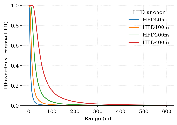
Whitepaper figure: hazardous fragment hit probability versus range, generated by the same code the watch runs. Illustrative interior; anchored at the hazardous fragment distance
The Long WalkUnclassified
Feature · Common Picture
The walk shows up on the team picture
- Watch position feed. The watch posts its position to a secure relay every five seconds; the relay converts it to cursor-on-target and the technician appears on the Team Awareness Kit map.
- Hazard rings on the map. The same bridge pushes the incident point and its cordon rings to the common operating picture, color-coded, so the whole team sees the geometry the technician is walking.
- Transport-layer security end to end, token-authenticated, on infrastructure the author operates.
- Optional by design. The feed is off unless the operator configures it; the watch works fully standalone.
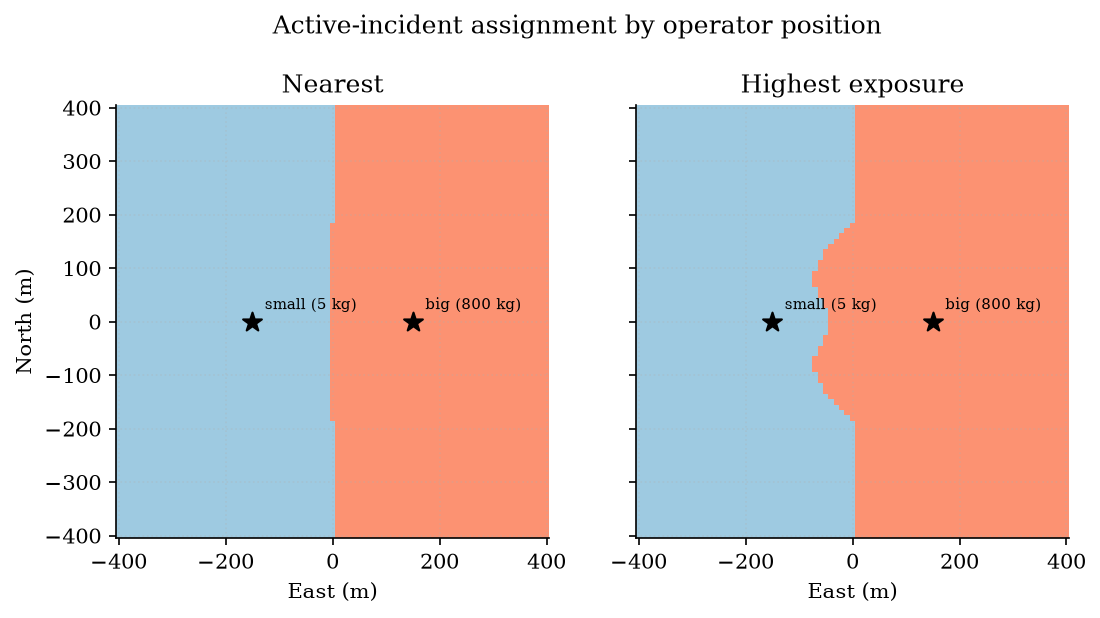
Multi-incident assignment: which technician takes which device, computed from exposure
The Long WalkUnclassified
Walkthrough
Incident to cordon in under a minute
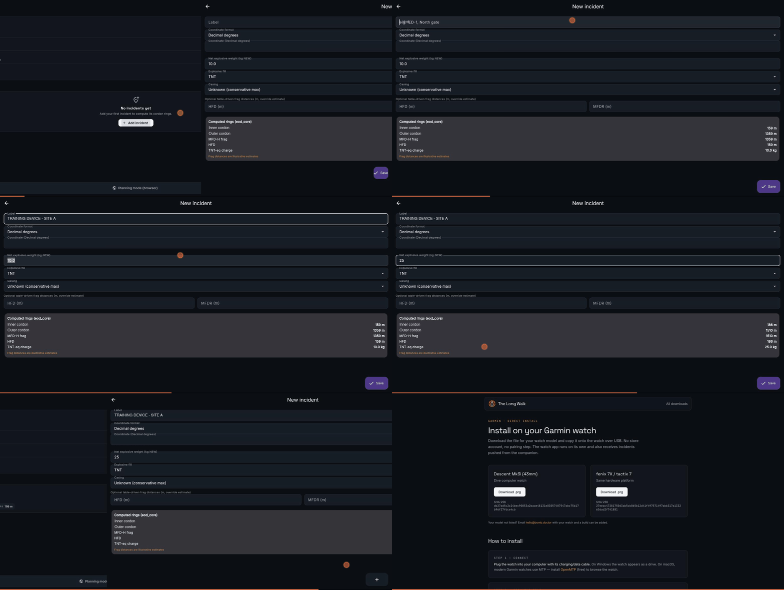
Recorded against the live planning app: ready check, incident entry with live ring computation, saved incident, direct-install page
The Long WalkUnclassified
Distribution and Status
Ships without a store
- Direct install. Watch builds download from bomb.doctor with checksums and a four-step universal serial bus install guide. No account, no store approval in the loop.
- Planning mode in any browser today; the same app builds for both major phone platforms, and the store submission kit is ready when accounts open.
- On the wrist now as a beta on dive-computer and tactical watch hardware.
- Sequencing is deliberate. Civilian and allied users first; government sales wait for the author's separation date to clear conflict-of-interest rules.
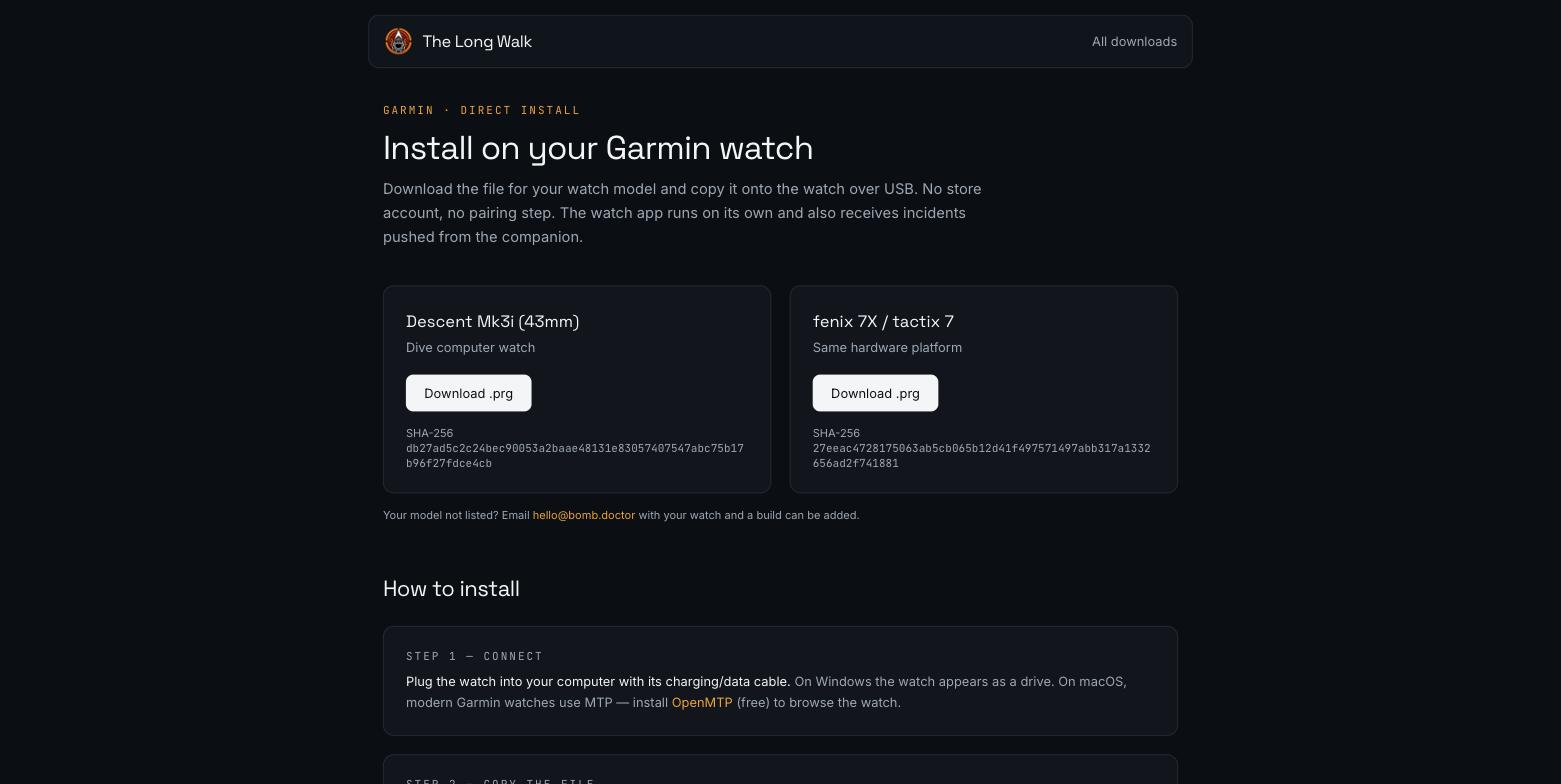
Per-model downloads with checksums at bomb.doctor/garmin.html
The Long WalkUnclassified